OpenIR (Open Infrared) is a major new project that democratizes infrared satellite data by making it available in an easy-to-use web-based map format. Developed by members of DuKode and MIT, OpenIR makes IR maps more understandable in web browsers, usable with crowd maps, and useful through the system’s automated risk-map algorithms.
OpenIR will be pilot tested in Indonesia, where ecological and economic vulnerability is apparent from frequent seismic activity and limited supporting infrastructure. This pilot test is supported by an MIT IDEAS Global Challenge Award.
For more info, please visit the OpenIR site: http://openir.media.mit.edu.
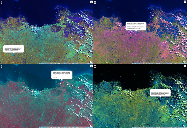
4 screenshots from OpenIR’s Jakarta Data Viewer prototype, which displays satellite images compiled from different IR spectral combinations. Annotations explain how different combinations highlight different environmental features.
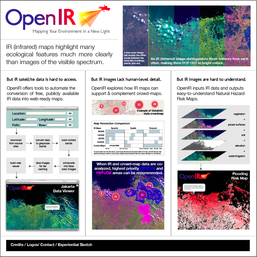
A poster (work-in-progress) explaining OpenIR’s innovations.
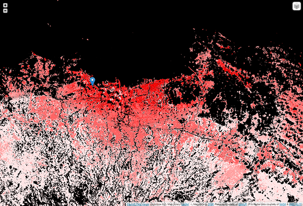
A screenshot of OpenIR’s initial Jakarta Risk-map. This map was created manually, but the OpenIR team is developing algorithms to automate the compilation of these maps based on IR data inputs. See OpenIR’s Technology section for more info.

